.jpg&w=3840&q=75)
BSP Network Map
Bergkamen
BSP Network Map
Table of contents
Bergkamen
BSP Network Map
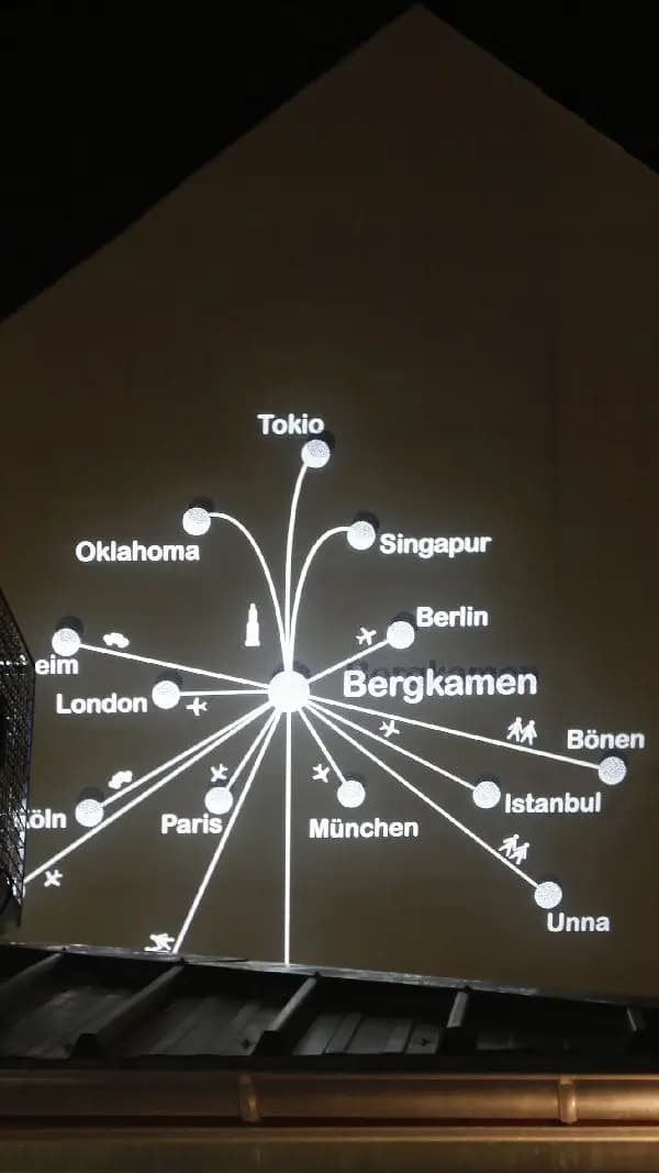
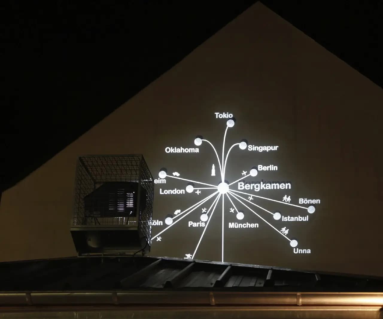
Das Kunstwerk „Netzkarte (BSP)“ von Rochus Aust entstand in den Jahren 2009 und 2010. Es befindet sich am Platz von Gennevilliers in Bergkamen. Diese Installation ist der zweite Teil des Projekts „subport bergkamen“. Sie ergänzt den fiktiven Flughafen in der Fußgängerzone.
Zeit statt Kilometer
Die Karte zeigt Städte in Deutschland und der Welt als Lichtpunkte auf dem Boden. Die Anordnung folgt nicht der gewohnten Geografie. Die Abstände richten sich nach der Reisezeit. Diese Form der Darstellung heißt Tempografie. Ferne Metropolen rücken dadurch in die unmittelbare Nähe. Bekannte Orte aus der Region wirken dagegen weit entfernt.
Der fiktive Flughafen
Das Kunstwerk thematisiert die Wahl des Verkehrsmittels. Mit dem Flugzeug ist Bilbao schneller erreichbar als die Nachbarstadt Iserlohn zu Fuß. Der „subport“ dient als symbolisches Tor zur Welt mitten in der Stadt. Er verbindet Bergkamen mit Orten wie Tokio, Berlin oder Rom. Der Mensch fühlt sich im globalen Dorf zu Hause. Gleichzeitig verliert er den Bezug zu seiner direkten Nachbarschaft.
Licht in der Nacht
Die Installation wird täglich mit Beginn der Dämmerung aktiv. Die Projektionen leuchten bis 24:00 Uhr. Das Konzept beruht auf einer Idee von Heinz Friedl. Die leuchtende Karte macht die Verbindung zwischen Bergkamen und der Welt für Passanten sichtbar. Das Werk lädt dazu ein, den eigenen Standort neu zu bewerten.